
Myanmar Spring Chronicle – Scenes from October 1
(MoeMaKa), October , 2026
The Growing Scale of Flood and Landslide Damage in the Dawei Region
The extent of the damage caused by the floods and landslides that struck Launglon and Thayetchaung townships in Dawei District, Tanintharyi Region, in late September is gradually becoming clearer.
The death toll continues to rise day by day, while reports from news outlets and humanitarian organizations reveal growing damage to homes, livelihoods, roads, bridges, electricity infrastructure, schools and religious buildings.
According to information available as of late October 1, the death toll from the floods and landslides in the Dawei region had risen to 41.
Of the 41 people who died, 31 were from Launglon Township, while the remaining 10 were from Thayetchaung and Dawei townships, according to news reports.
In Kadet Nge Htein village, in southern Launglon Township, 15 people were reportedly killed in that village alone.
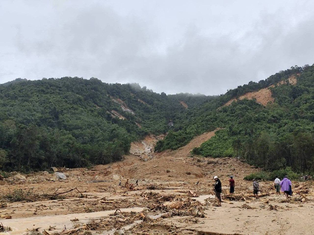
After hours of torrential rain, landslides came down from the mountains. Torrents of water, mud and earth swept through villages, destroying homes and burying some beneath the debris.
The flooding and landslides began on the night of September 26. As enormous amounts of rain triggered landslides, houses were buried under earth and debris. Some residents died trapped beneath collapsed homes and mud, while rescuers found a smaller number of survivors with injuries.
Launglon Township is shaped somewhat like a peninsula, stretching from north to south. The main road from Dawei runs lengthwise from the northern end toward the south.
Landslides buried sections of this only major road under several feet of mud, preventing rescue teams from reaching affected villages immediately after the disaster.
During the first few days, heavy machinery had to be used to clear the mud covering the road.
During that period, there was little visible involvement by the Tanintharyi regional authorities in rescue operations or in deploying heavy machinery available to government departments such as construction and irrigation, according to the reports cited in this account.
Relief operations in both Launglon and Thayetchaung were instead largely carried out by nongovernmental rescue organizations.
The Zambuthiri Social Rescue Organization, based in Dawei Township, was among the first groups to begin rescue operations.
A report also emerged that volunteer organizations traveling from other areas to assist Launglon and Thayetchaung would need to present documentation at military checkpoints along the Dawei-Launglon road, including an endorsement from Zambuthiri, a list of relief supplies and information about participating vehicles and machinery.
Zambuthiri later clarified on its social-media page that reports claiming its endorsement was required were incorrect. The organization explained that the misunderstanding apparently arose because checkpoint personnel had asked other relief groups to provide information similar to the documentation Zambuthiri itself had submitted during its operations.
Some rescue and humanitarian organizations from outside Tanintharyi Region, including groups from Mon and Karen states, have also traveled to the flood-hit Dawei area to provide assistance.
The article states that, as of the time of writing, no clearly visible large-scale relief operation by the military authorities had yet been observed.
At the same time, reports emerged that the military carried out airstrikes on villages in Thayetchaung Township on October 1, even as the township was struggling with the aftermath of flooding and landslides.
No casualties were reported from those airstrikes. Nevertheless, carrying out attacks while rescue and relief operations were underway in Launglon and Thayetchaung presented a particularly disturbing situation.
A few days after the flooding and landslides struck Launglon and Thayetchaung, Tanintharyi Township, farther south in the region, also began experiencing flooding.
Heavy rainfall caused the Tanintharyi River to rise, inundating a number of villages.
Launglon Township relies heavily on fishing, rice cultivation and plantation agriculture for local livelihoods. Since the military takeover, it has also become known as an area where armed resistance has been particularly active.
The military has largely maintained control over Launglon town itself, while local PDFs have mounted strong resistance in many surrounding villages over the past several years.
Geographically, the township’s peninsula-like shape and its single main north-south road may provide certain advantages to resistance forces operating in the area.
Although Launglon is one of the townships closest to Dawei, the military authorities have been unable to establish effective control over much of the township beyond Launglon town.
The article therefore argues that the area’s military situation and the authorities’ lack of territorial control may help explain the limited government relief presence in areas controlled or influenced by armed resistance groups. This is an interpretation based on the circumstances described, rather than a confirmed explanation from the authorities.
The floods and landslides have killed dozens of people. Rebuilding damaged roads, bridges, electricity systems, schools and livelihoods will require both substantial funding and considerable time.
However, because Launglon and Thayetchaung are regarded as conflict-affected areas, the article concludes with concern that the military authorities may provide little support for their longer-term reconstruction.