
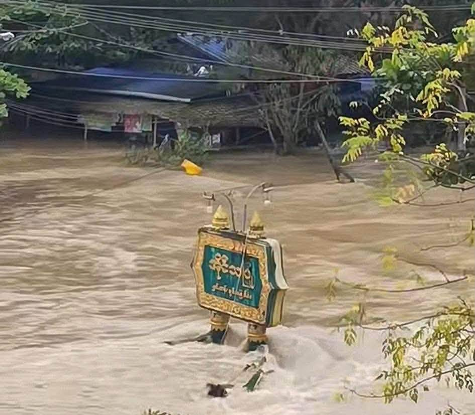
Myanmar Spring Chronicle – Scenes from August 17
(MoeMaKa), August 18, 2026
Another Round of Flooding Hits Laymyethna Township Before Breached Embankment Can Be Repaired
The embankment west of Laymyethna town, built to hold back the Ngawun River—a tributary of the Ayeyarwady River—was breached on the night of July 30. Before the breach could be sealed, rising water levels in the Ayeyarwady River have caused another surge of flooding. Water has now risen above the levels seen in recent days, inundating towns and villages that had remained dry during the previous weeks.
Floodwaters entering through the breached embankment near Laymyethna have spread beyond Ngathaingchaung and Kyonpyaw, reaching as far as Yegyi.
In recent days, increased volumes of water flowing south from the upper Ayeyarwady River into Ayeyarwady Region have caused water levels to rise in Laymyethna and neighboring townships, putting one area after another at renewed risk of flooding.
On August 17, floodwaters entered wards in Ngathaingchaung town, with water levels reportedly rising by about three feet within a single day.
Reports also indicate that water has begun rising again in areas where it had receded over the previous few days, reaching places that had not previously been flooded. Some roads being used for relief and rescue operations have been overtopped or submerged. In addition, floodwaters have reached some temporary evacuation sites, forcing displaced residents to relocate once again.
The ongoing flooding in Ayeyarwady Region covers a vast area and has affected hundreds of thousands of people. Damage to cultivated paddy fields and other crops has also been extensive.
Earlier this rainy season, the first major flooding occurred in northern Rakhine State, including Kyauktaw, Mrauk-U and Ponnagyun townships. Those areas experienced flooding for around a week in early July. In northern Rakhine State, the Arakan Army (AA) administration, which controls the area, carried out rescue and relief operations.
The next major flooding occurred after the embankment along the Ngawun River near Laymyethna in Ayeyarwady Region was breached. Laymyethna and surrounding low-lying areas have now been affected by flooding for nearly three weeks.
Only a few days after Laymyethna and nearby townships were inundated, the Thaphanseik Dam in Sagaing Region reached capacity and water was released through its spillway. This resulted in flooding across the Mu River basin, affecting at least 10 townships, and the flooding has continued into recent days.
Over roughly the past two months, floods have struck western Myanmar, the Ayeyarwady Delta and central Myanmar. Of these affected areas, the military regime has been seen carrying out rescue and relief operations only in Ayeyarwady Region. In the other two areas, assistance has largely been provided by ethnic armed organizations and resistance forces controlling those territories, their local administrations, and community-based relief organizations.
It is impossible to know whether the military is pleased to see natural disasters affecting territories controlled by resistance forces. However, its refusal to allow relief supplies to be delivered to these areas, or humanitarian organizations to enter them, makes it clear that natural disasters are being exploited as a political and military weapon.
Even in Ayeyarwady Region, where humanitarian assistance is not blocked, relief organizations arriving from other areas have been unable to meet the scale of need. They are also facing difficulties obtaining fuel, which is essential for rescue and relief operations. Although fuel and consumer goods are not prohibited from being transported into Ayeyarwady Region, fuel stations are reportedly allowed to sell rationed quantities only for officially registered vehicles and motorcycles. During the current disaster, these restrictions have resulted in shortages and forced relief workers to purchase fuel at much higher prices on the black market, delaying aid operations.
As a result, rescue and relief efforts in places such as flood-affected Sagaing Region are even more difficult. Assistance from humanitarian organizations and mutual aid among local communities has been unable to reach many of those in need.
Among international organizations such as the United Nations World Food Programme (WFP), reports of flood-relief assistance have so far been seen mainly in relation to Ayeyarwady Region. No information has yet emerged about WFP assistance for flood victims in Sagaing Region.
Despite widespread flooding across the country, the military continues its offensive operations and regular aerial bombardments. Fighting is ongoing in Thabaung and Yegyi townships near the Rakhine State border, not far from flood-hit Laymyethna in Ayeyarwady Region. Military columns are also active in areas of Magway Region that could face flooding.
In addition to discriminating among flood-affected areas and restricting humanitarian assistance, the military authorities have not been seen mobilizing relief and rescue efforts to the fullest extent of their capacity. Meanwhile, the prime minister and ministers of the military regime have made statements such as promising assistance to farmers to grow alternative crops if their paddy fields are destroyed.
Taken together, these actions leave little room for any conclusion other than that the military regime is using natural disasters as a political weapon.