
Myanmar Spring Chronicle – View from September 22
(MoeMaKa, September 23, 2025)
Disaster preparedness under military rule amid war and natural hazards
During July–September—the Northern Hemisphere summer—tropical cyclones typically form. In recent years, influenced by global climate change, these storms have grown more intense, and episodes of torrential rain have become more frequent. Cyclones in the Bay of Bengal and South China Sea during July–September are increasingly powerful.
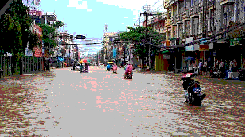
In September last year, Cyclone Yagi caused heavy casualties and damage across Vietnam, China, the Philippines, Laos, Thailand, and Myanmar. In Myanmar’s Shan State, Mandalay Region, Bago Region, and Karen State, there were sudden flash floods; homes and villages were inundated. Places such as Yamethin, Tatkon, Taungoo, Naypyitaw, Kalaw, eastern Shan State, and Inle suffered widespread flooding, landslides, and areas swallowed by sinkholes/subsidence.
Although countries like the Philippines, Vietnam, China, Laos, and Thailand also took losses, Myanmar—which was struck later by the storm’s weakened remnants after landfall further east—ended up with the highest death toll. While Vietnam recorded over 320 deaths from the cyclone, Myanmar saw over 430 deaths due to the ensuing heavy rains and landslides.
Why did places that faced Yagi at full strength suffer fewer deaths than Myanmar? Largely because their governments issued adequate advance warnings, organized evacuations for at-risk areas, and mobilized assistance—actions that reduced fatalities.
Why couldn’t Myanmar do the same? Because of an incapable administration, a regime that prioritizes war efforts over disaster prevention and relief, and a lack of rapid rescue capacity—insufficient personnel, funds, and equipment. These factors made Myanmar the country with the most deaths among the six affected by Yagi.
This year, in mid-September, the strongest cyclone of 2025, “Ragasa,” formed over the South China Sea. It has passed north of the Philippines over open water and is moving westward. Its track lies slightly south of last year’s, and its **diameter—over 730 miles—**is even wider than Yagi’s. In the coming hours and days, it is expected to affect Vietnam, southern China, and Laos.
Although both social and traditional media have carried warnings, inside Myanmar there has been no visible preparation for the inland impacts of the storm’s remnants—no proactive evacuation notices for specific localities. The Meteorology Department has issued only generic advisories about landslides and flooding; local authorities have not, as yet, ordered evacuations or provided the support and logistics such moves would require.
Because Ragasa’s track is farther south than Yagi’s, heavier rains may hit not only eastern Shan State but also Kayah (Karenni), Karen, and Mon States.
Last year’s high-fatality areas—Yamethin, Tatkon, Kalaw, etc.—are places the junta claims to fully control. Yet there were no advance warnings or evacuations, and after the disasters there was no rapid rescue.
The coup regime has prioritized retaining power and winning the civil war over disaster preparedness and relief. This year’s cyclone, potentially stronger than Yagi and tracking slightly to the south, is approaching while the junta focuses on elections, conscription, and military operations against ethnic armed organizations and PDFs. Meanwhile, the patchwork of territories controlled by different armed groups—and the checkpoints and movement restrictions between them—further complicate safe evacuation.
In the coming days, as natural hazards strike, Myanmar’s civilians—already trapped amid a civil war—will likely have to face them in a save-yourself situation, with little coordinated help.