
Myanmar Spring Chronicle – June 14 View
(MoeMaKa, June 15, 2025):
Regions Likely to Face Flood Risks Again
Amid ongoing civil war, with deadly violence, displacement, and destruction, and following the devastating March earthquake (the strongest in 80–100 years), people in Myanmar now face another recurring annual danger: natural disasters, specifically floods.
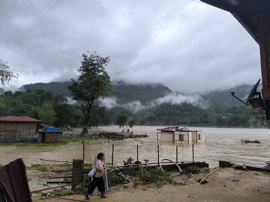
While it’s still uncertain which regions will be hit hardest, flood risk is currently most visible in southern Shan State’s Inle Lake region near Nyaungshwe, where unseasonably high water levels have already been observed. In towns like Taunggyi, Kalaw, and Inle, heavy rainfall in recent days has raised the lake’s water level by nearly five feet—causing concern among locals still recovering from earthquake damage.
In the aftermath of the March 28 earthquake, Inle was among the affected areas, with damaged homes and religious buildings still under repair—or not yet rebuilt. The unexpected early rise in water levels has raised fresh worries about flooding.
Normally, Inle Lake floods in September or early October, during the late monsoon. This year, however, June—technically early monsoon season—has already brought flood conditions.
Globally, climate change is causing more extreme weather events, and Myanmar is no exception. Heavy rains, stronger cyclones, and excessive resource extraction, especially deforestation and mining, are worsening flood risk. River sedimentation, changing watercourses, and loss of forest cover have all become major contributing factors.
Flooding has already been reported this monsoon season in Kachin State’s Myitkyina and upstream Hpakant and Chipwe areas. These may not be the last such incidents this year.
In parts of Kachin, Shan, Sagaing, and Mandalay, mining activities (especially gold extraction) have altered river flows and increased siltation, making downstream villages more vulnerable to floods during heavy rainfall.
Residents in conflict-affected areas now face the dual threat of civil war and natural disasters. Some must make impossible decisions—which danger to flee from first: armed conflict or rising water?
In war zones, responding effectively to natural disasters is extremely difficult. Financial and human resources are largely consumed by the conflict, making rescue and relief operations harder.
Since the 2021 coup, Myanmar has suffered multiple natural disasters. Yet the military junta, which controls much of the country’s natural and financial resources, has failed to provide effective disaster response.
For example:
-
In 2023, Cyclone Mocha devastated northern Rakhine.
-
In 2024, heavy rainfall following remnants of Cyclone Yagi caused major flooding in parts of Mandalay and Shan.
The junta’s disaster response efforts in both cases were widely seen as inadequate.
In some flood-affected areas, territorial control is fragmented—with some fully under ethnic armed groups, and others under no group’s full control. In these ungoverned areas, aid delivery is especially difficult, as conflict, insecurity, and unpredictable clashes pose serious threats to relief missions.
This was seen during the March earthquake in Sagaing Region, where aid to villages in Mingin and other townships had to be delayed due to security concerns.
In conflict conditions, disaster preparedness, early warning systems, and contingency planning are often underfunded or neglected. The junta prioritizes military spending, while resistance and ethnic groups lack governance capacity, resources, and disaster response experience.
This leaves local communities largely on their own to recover from earthquakes, floods, and other crises. Rebuilding requires enormous physical, financial, and emotional strength.